One Photo. One Map. Cleaner Water.
Take one photo, answer three quick questions and help build a privacy-first community dataset about commercial waste, rain exposure and potential stormwater pathways.
Public by choice. Private by default.
Owner names, exact addresses and site photos stay private unless the owner chooses public recognition.
Founding Public Map Sponsorship — Request a Written Quote
Support the privacy-first public map and receive factual sponsor recognition beside the experience.
Public. Opted-in. Municipal.
Our one Community Map uses privacy-based permissions: approved public geography, explicitly permitted participating-site details, and a restricted municipal workspace when available. These are not separate public maps.
1. Public Community View
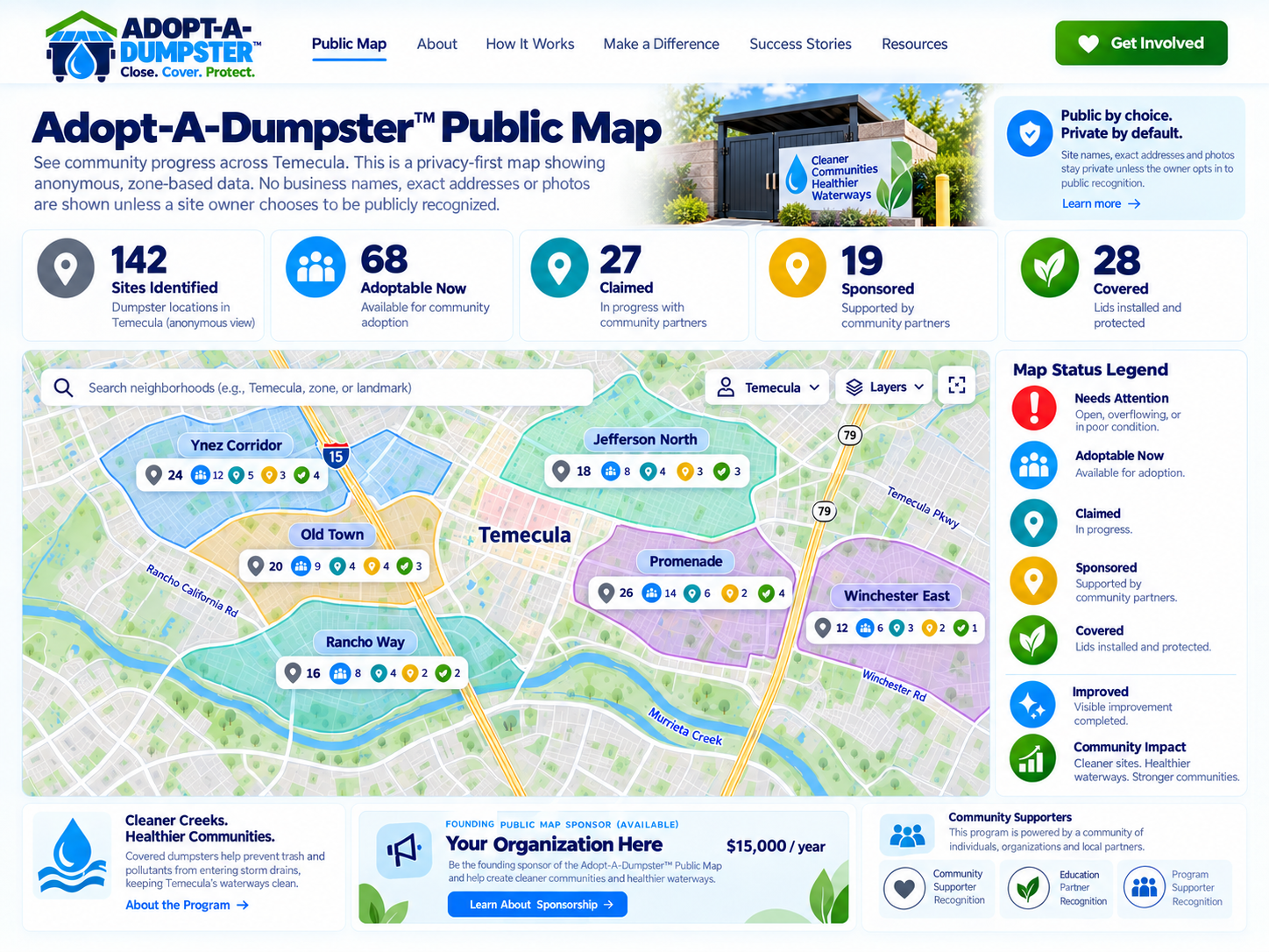
Anonymous zone-level progress before owner opt-in. Founding Public Map sponsorship can appear on this public-facing experience.
View both cities, explore public planning districts and wards, and learn how Adopt-A-Dumpster protects waterways. Verified site activity will appear only after review. Individual inspection records remain private.
PROVISIONAL PILOT SITES
GENERALIZED MAP AREAS
OWNER-OPTED-IN SITES
Public locations are generalized by default. Exact coordinates are released to the public layer only after explicit site-level permission. Pilot counts shown here come from the public program feed and remain subject to staff confirmation of verified, unique locations.
2. Opted-In Sites View
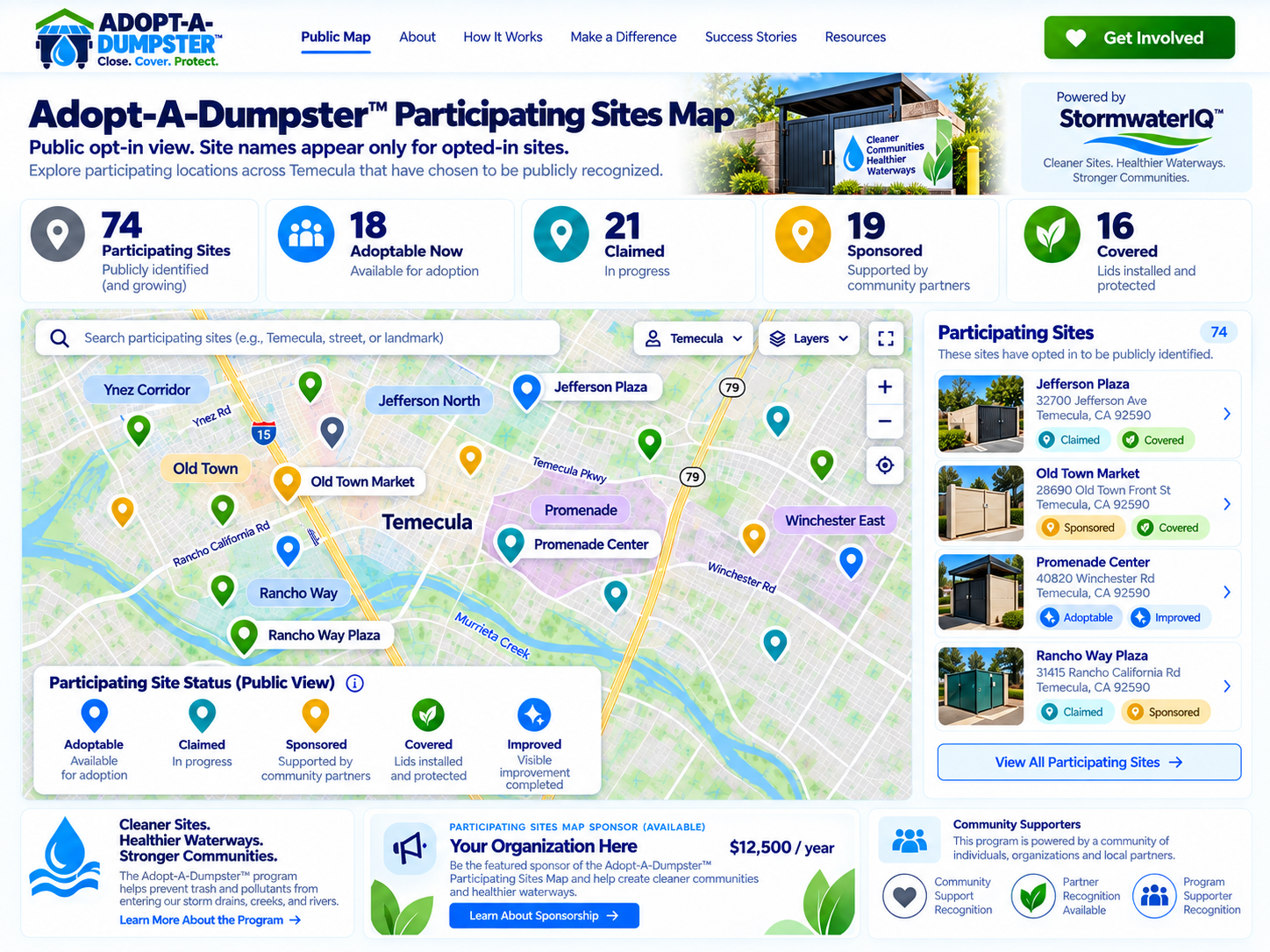
Individual participating sites appear only after owner approval. Ask about Founding Participating Sites Map sponsorship opportunities. Availability, scope and pricing are confirmed in writing before any commitment.
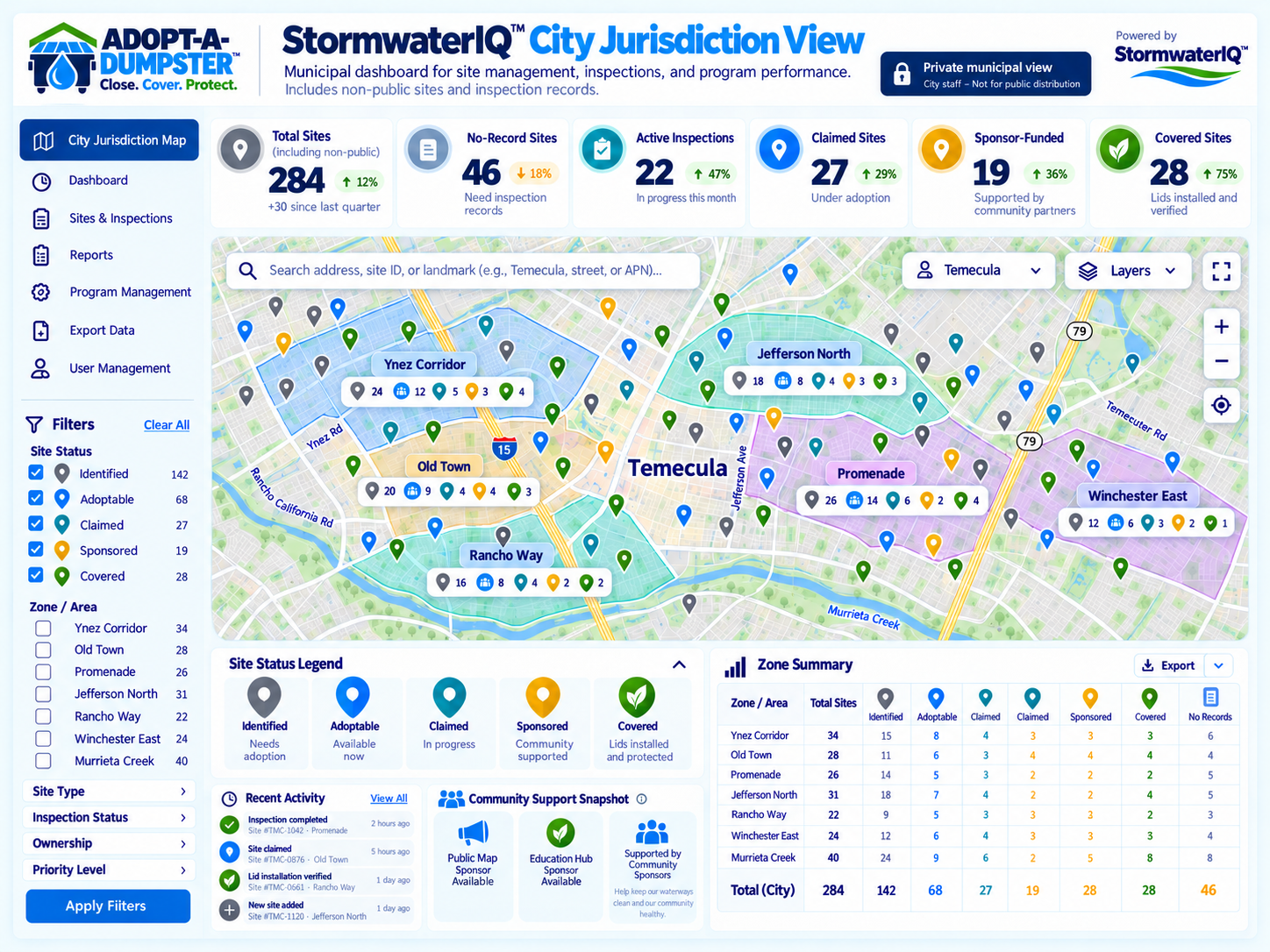
3. Private City View
Concept preview only: a future authorized municipal workspace may provide deeper operational records after separate GIS, privacy and access reviews. No municipal dashboard is being offered as a live Public v1 feature.
Live privacy-safe community map
This public v1 map displays only staff-approved Adopt-A-Dumpster records through the WordPress privacy-safe feed. No unreviewed sites or exact location pins are public. Advanced Survey123/ArcGIS integration is not active in this public view.
Where community donations can help most
Understanding priority areas
Adopt-A-Dumpster is building a risk-informed way to identify eligible dumpster areas needing covers, gate repairs, drainage controls or other practical improvements. The most urgent candidates will be assessed using verified field conditions, runoff pathways, watershed exposure, community benefit and readiness—not appearance or distance to water alone.
Current map status: The single interactive map is available on our Community Map page. Risk rankings and a public priority overlay are still in development; these legend categories do not claim that any specific site has been rated or funded.
Exact location data, owner information and site photos stay private unless appropriate public-display permission is obtained. We may report aggregated priority areas only when that disclosure does not reveal an unconsenting property. See how general donations are prioritized →
Open the single live Community Map
Accessible text list of public pilot activity areas
This list is drawn only from the approved public map feed. Generalized locations do not identify private properties.
For privacy, generalized pins do not identify an individual unclaimed business or dumpster area. The private municipal layer remains separate from this public map.
Neighborhood Progress
Neighborhood zones show aggregate activity without exposing individual unclaimed businesses.
Participating Sites
After an owner opts in, that participating site can appear as an individual public pin.
Sponsor Recognition
Public recognition can connect a sponsor to a participating local improvement.
Covered Sites
Completed improvements can be documented with status, photos and ongoing upkeep.
Zones first. Individual pins only after opt-in.
The examples below show the public experience we are building. Unclaimed activity stays at the zone level. Individual participating sites appear only after the owner chooses public recognition.

Anonymous community progress.
Before owner opt-in, the public view shows neighborhood or community zones and aggregate activity. No unclaimed business name, photo or exact site pin is shown.
This is the default public privacy layer.
Founding Public Map Sponsorship · Request a Written Quote
One sponsor may receive factual acknowledgment across the public zone view and opted-in participating-sites view.
Interface preview showing the intended public community experience. Example data only. Sponsor placement shown is conceptual and does not represent an actual sponsor.
Interface preview of the opted-in public view. Individual pins represent participating sites only after owner approval. Example data only. No actual sponsor is represented.

Public recognition after the owner opts in.
Once a business chooses public recognition, its participating site can appear as an individual pin with the information the owner approved for display.
Not all program sites are shown publicly.
Founding Participating Sites Map Sponsorship — Request a Written Quote
Recognition appears on the opted-in public map experience after participating owners choose public visibility.
Owner opt-in comes first.
No owner name, exact address or site photo goes public just because a location was identified.
A public map should reward participation, not create a shame list.
The public experience focuses on positive progress. Sites that have not opted in remain private. Participating owners decide how they want to be recognized.
One view for public participation. Better records behind the scenes.
The map can help communities show participation and visible improvement while StormwaterIQ™ supports the underlying site records, documentation and schedules.
Want your site to be part of the map?
Claiming is free. You choose whether your business appears publicly.